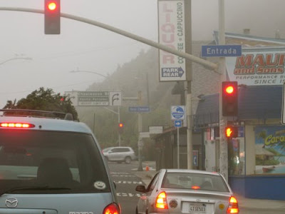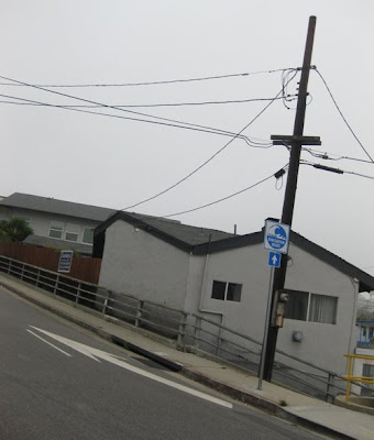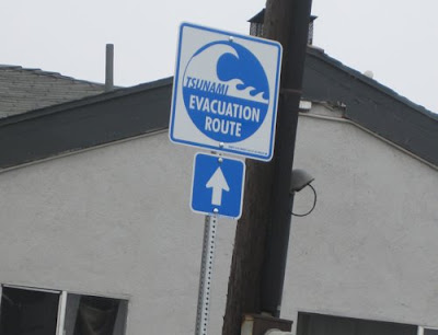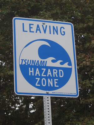
It appears that the tsunami sign terror campaign aimed at Los Angeles beachgoers is being waged by the city of Los Angeles itself. The "TSUNAMI HAZARD ZONE" and "TSUNAMI EVACUATION ROUTE" signs that have appeared on the Pacific Coast Highway and its access road intersections are marked "Property City of Los Angeles."
The signs also bear the name "Maneri." The Maneri Sign Company is located in Gardena (City Hall reporters, do your thing...)

Our favorite so far?

At the three-way intersection of the PCH, West Channel Road and Chautauqua Boulevard, where drivers can leave the PCH and head along the low, flat West Channel into Santa Monica, or take a steep, rising hill up into Pacific Palisades.


Chautauqua Boulevard-- the steep, rising hill-- is marked "TSUNAMI EVACUATION ROUTE," as if one fleeing rising waters would need to be directed to choose the road leading to higher ground.

Drivers taking the low, flat West Channel Road route will find a LEAVING TSUNAMI HAZARD ZONE sign a couple of hundred yards down the road. That would be a couple of hundred yards away from the beach and the direction of the approaching waters.
An investigation today revealed that the TSUNAMI EVACUATION ROUTE signs are posted along the Pacific Coast Highway before all major access roads north of the California incline in Santa Monica and south of Malibu (Veronique de Turenne of the Here in Malibu site tells us the signs have not been posted in Malibu).

The appearance of the signs has more than a few people wondering why the government would want to drive tourists and beachgoers away from the vast, wide beaches of Will Rogers State Park. There are suspicions that government officials have some advance warning of an impending earthquake or underwater test that would trigger a tsunami-- a long high sea wave caused by an earthquake, submarine landslide or other disturbance.
A 2004 study by researchers at the University of Southern California showed that a 7.6 magnitude earthquake could cause the seafloor under Catalina Island to be thrust upward violently, causing a tsunami along the Southern California coast.
The researchers at the Viterbi School of Engineering described the tsunami hazard associated with offshore faults, including one that lies under Santa Catalina Island, just 25 miles off the Los Angeles coast.
"Catalina Island itself exists due to earthquake-related uplift on a geologic structure known as a restraining bend," said Mark Legg, a geophysicist working with the USC researchers, in the August 2004 issue of Earthquake Spectra.
"Although most faults offshore Los Angeles and Orange counties are mostly strike-slip-- faults that move side to side-- bends in the fault line produce areas where the ground is pushed up during major earthquakes. One of these regions lies directly below Santa Catalina Island."
"Strike slip faults are not straight," added Jose C. Borrero, assistant research professor in the USC Viterbi School. "Bends in the fault trace produce regions where earthquake stresses cause the sea floor to pop up and generate a tsunami".
A random survey of shoppers at the Gelsons supermarket in Pacific Palisades this afternoon found a majority of respondents reacting in bemused disbelief. Said one: "Fear. More fear."


